Sierra de Aracena Andalucia Walking Guide Book Map

 Sierra de Aracena
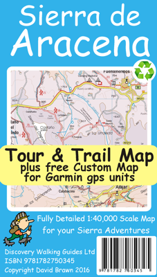
1:40,000 scale topographical map covering
the Sierra de Aracena region in northern Huelva/Andalucia.
All walking routes from Sierra de Aracena - a Walk! Guidebook; are clearly
highlighted.
Discover the hidden Spain of western Andalucia which is a delight for
leisure walkers who appreciate the natural world and 1st class culinary
delights; the Jabugo pata negra ham and local setas make for a unique dining
experience.
2nd edition includes 1 minute Lat/Long grid, road and development updates
and specially highlighted walking trails.
Sierra de Aracena Tour & Trail Custom Map is available as a free digital
download from Discovery Walking Guides website dwgwalking.co.uk for use in
Garmin gps units, Garmin Basecamp and Google Earth; see details on the map
for the free digital download or click on this link
Sierra de Aracena 2016,
Digital editions of this map are available for use on mobile phone apps from
Viewranger and MyTrails. Produced to Tour & Trail standards resulting in a
map of outstanding accuracy and clarity. Whether you are driving, walking,
hiking, horse riding or mountain biking this is the map to carry with you.
GPS
navigation files now available for Sierra de Aracena - see
PNFs
Sierra de
Aracena Tour & Trail Map at 1:40,000 scale covers our walking
region and beyond.£3.99.
![]()
